COPPERLINE PROPERTY
The Copperline Property comprises 6 mineral tenures totalling 945 hectares in the Omineca Mining Division of British Columbia. The property is located at Latitude 55°50’N, Longitude 126°36’W (NTS 93M/15E), approximately 120 km north-northeast of Smithers. Access is by helicopter from Smithers or via logging roads extending from the Nilkitkwa River area.
The property hosts a volcanic redbed copper-silver deposit with strong geological similarities to the Sustut copper deposit (Imperial Metals) located 80 km to the northeast. Volcanic redbed deposits are known globally for their potential size and grade, with world-class examples including the Calumet-Hecla deposits (Michigan, USA) which produced over 72 Mt at 2.64% Cu.
The Copperline Property surrounds Skutsil Knob at the south end of the Driftwood Range, hosting volcanic redbed copper-silver mineralization. (Vollo, 1974; Borovic, 1990).
Mineralization consists of disseminated and stringer bornite, tetrahedrite, chalcopyrite, and chalcocite with rare native copper, hosted within calc-alkaline volcanics of the Lower Jurassic Telkwa Formation, Hazelton Group (Weicker, 2001; Houles, 2003).
Source: Vollo (1974, 1975); Weicker (2001)
| Hole | Interval (m) | Cu (%) | Ag (g/t) |
|---|---|---|---|
| DR-9 | 25.0 | 2.54 | 50.4 |
| DR-11 | 9.1 | 2.94 | 83.3 |
| DR-12 | 3.0 | 3.05 | 78.9 |
| DR-1 | 12.2 | 1.62 | 35 |
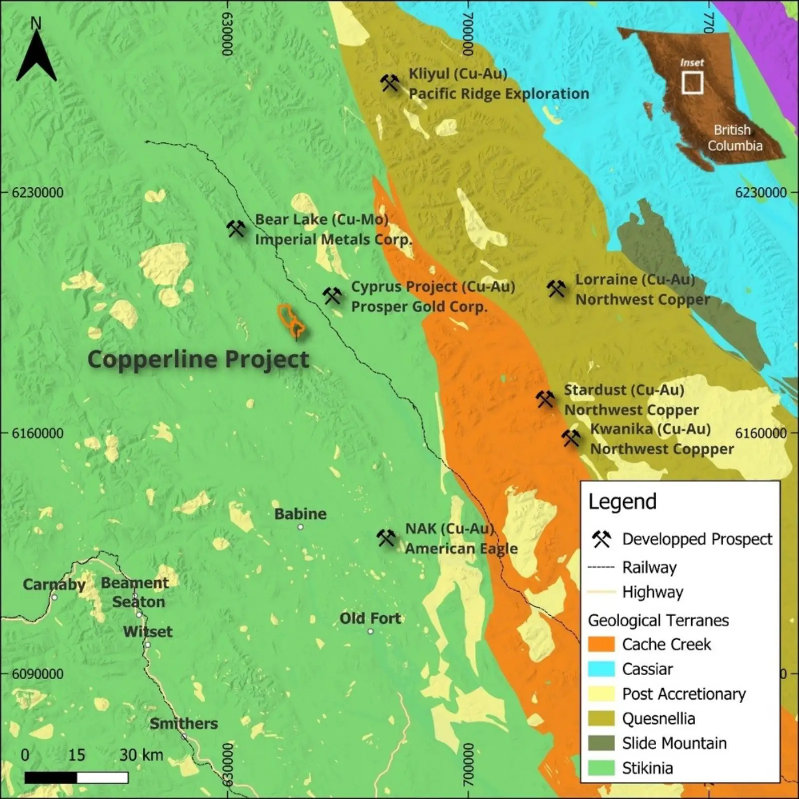
Copperline Project Location. Star Copper 2025. Click/tap image to enlarge.
Note: Historic results are exploration information only and have not been verified by a Qualified Person.
On October 30, 2025, a field crew was deployed by helicopter to the Copperline Property. Snow cover affected field conditions, with crews operating on snowshoes. Two field teams worked concurrently:
The 2025 soil sampling program was designed to follow up on anomalous copper-in-soil results identified during the 2023 program (Rodway, 2023). The 2023 program returned highly anomalous copper values in the southeastern portion of the grid, including results of 449 ppm Cu and 463 ppm Cu, with anomalies remaining open to the east and south.
The 2025 sampling targeted infill and extension of these open anomalies along four east-west lines:
| Line (UTM N) | Coverage | Objective |
|---|---|---|
| 6190600N | Extended to 650250E | Eastern extension of anomaly |
| 6190550N | Extended to 650250E | Re-sample, extend 463 ppm Cu area |
| 6190500N | Extended to 650250E | Re-sample, extend 449 ppm Cu area |
| 6190450N | 649925E to 650250E | Southern extension (new) |
Note: Historic results are exploration information only and have not been verified by a Qualified Person.
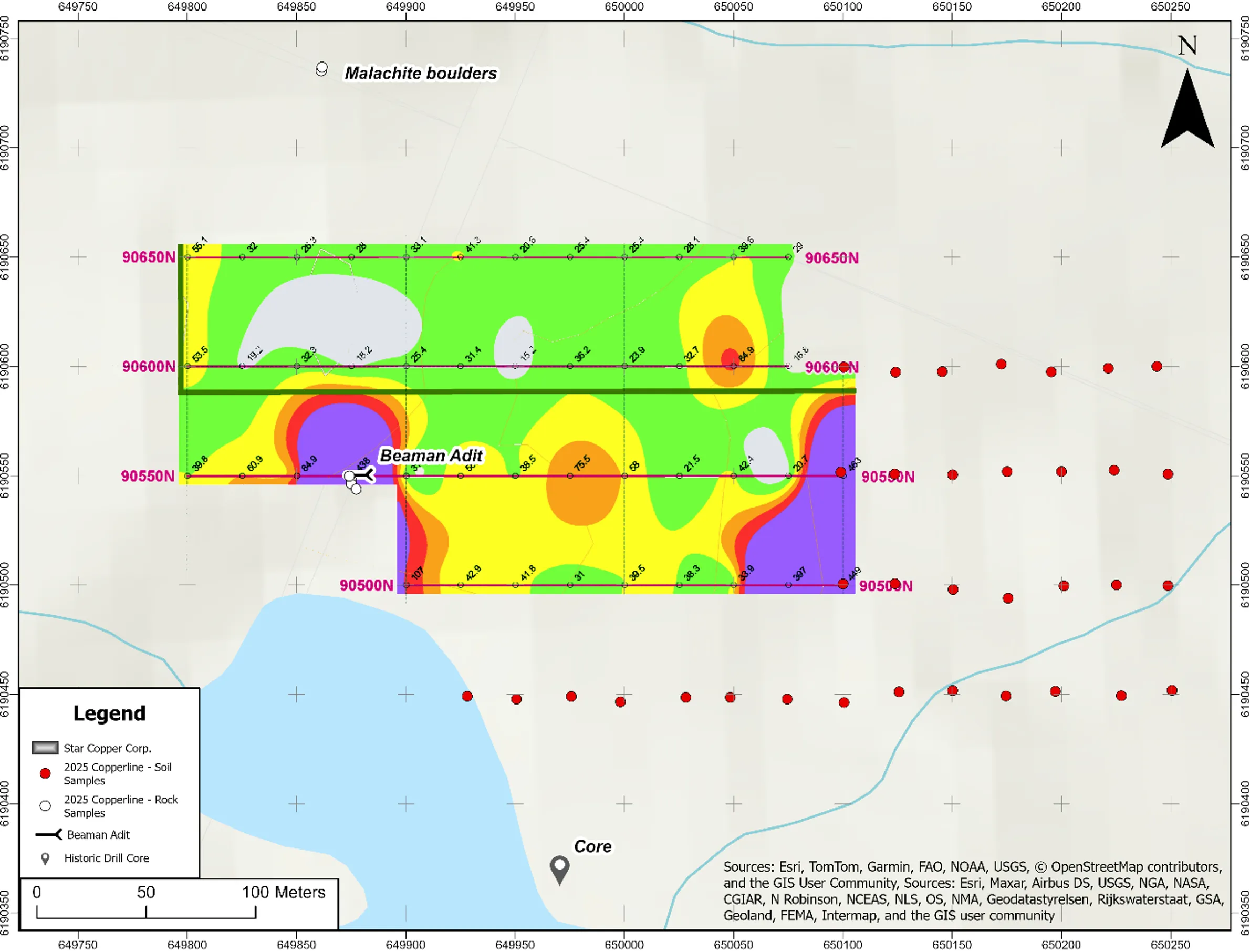
Location of 2025 soil sample lines (black) overlain on 2023 copper-in-soil geochemistry results (Rodway, 2023). Note anomalous values up to 463 ppm Cu in the southeast portion of the 2023 grid, which remained open to the east and south. Click/tap image to enlarge.
Despite challenging snow conditions, the prospecting team successfully confirmed historic mineralization and collected samples from multiple locations:
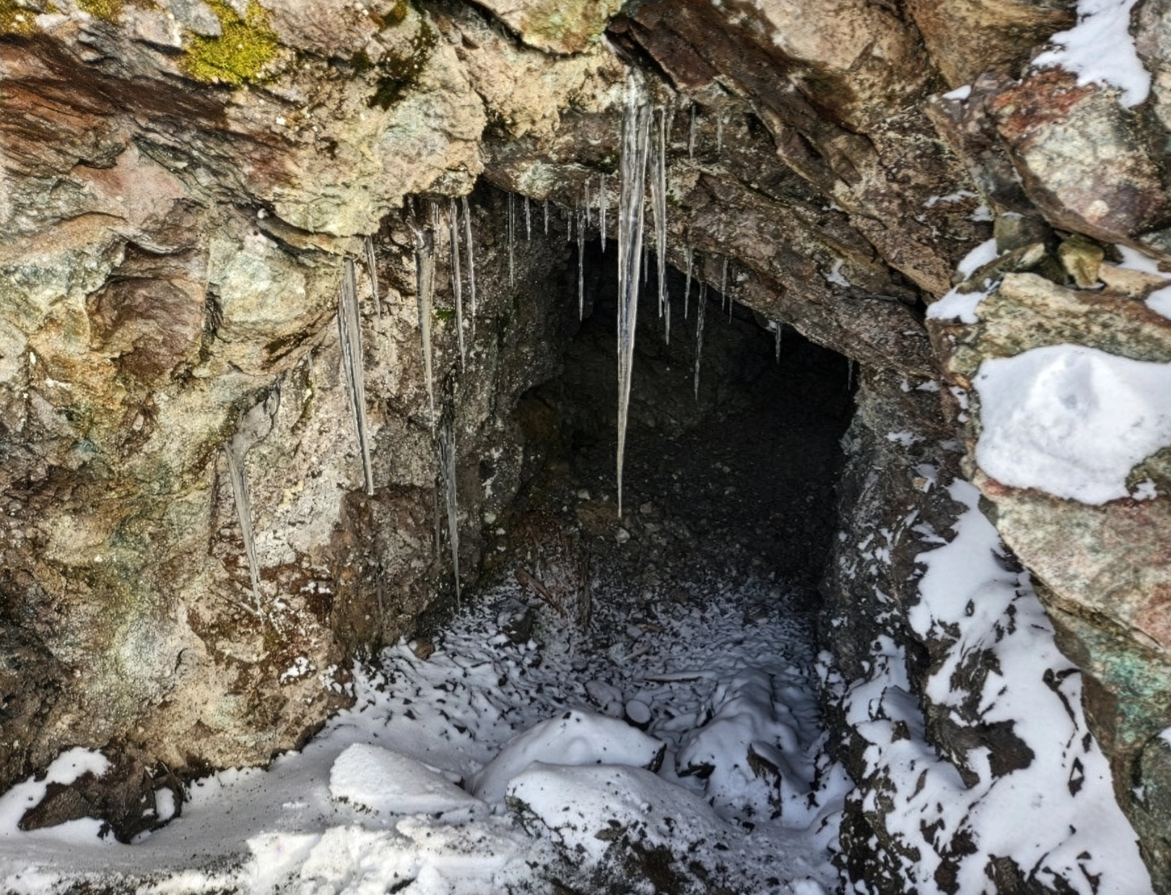
Beaman Adit (649878 E / 6190550 N)
Four grab samples were collected from the historic Beaman Adit and immediately adjacent areas. Visible malachite (copper carbonate) was observed, confirming copper mineralization at this location. A 2023 sample from this adit returned 1.93% Cu and 94.3 g/t Ag (Rodway, 2023).
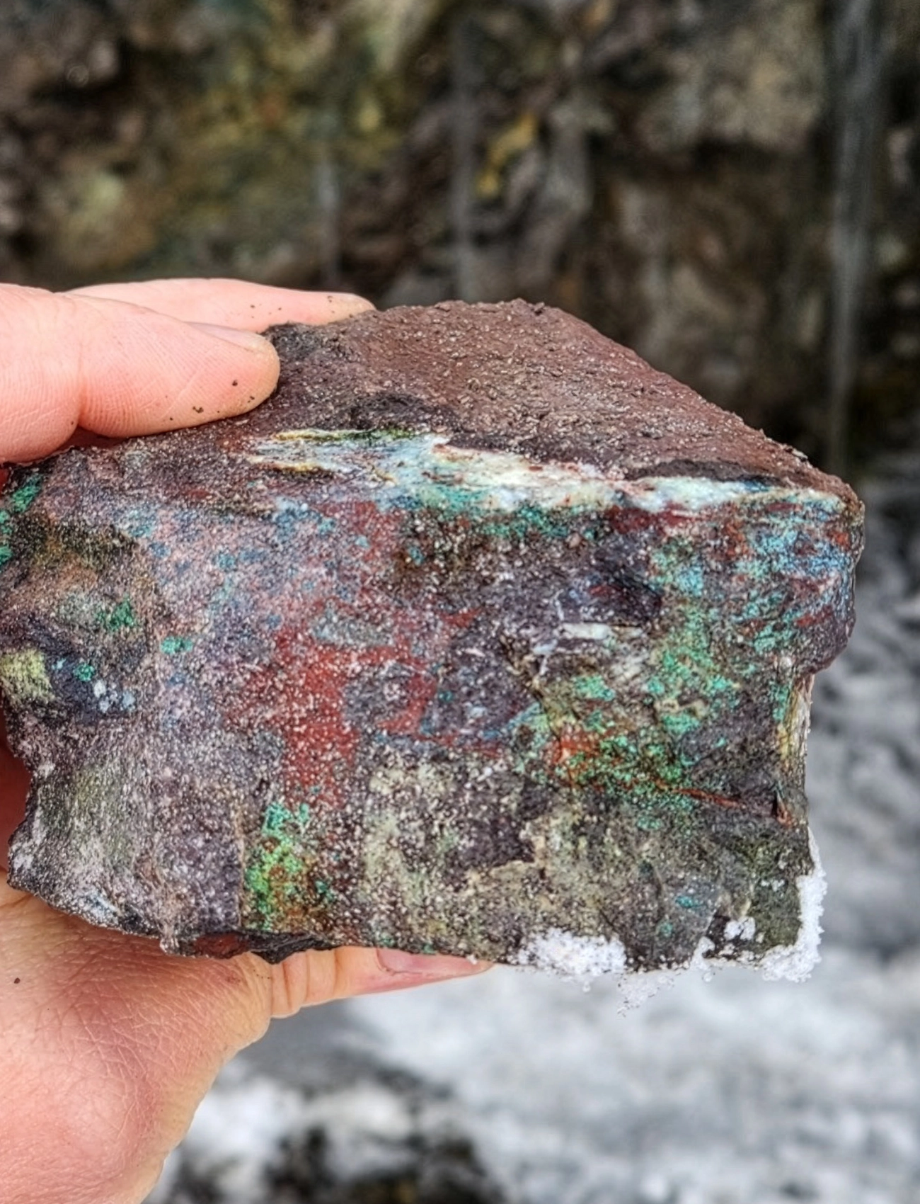
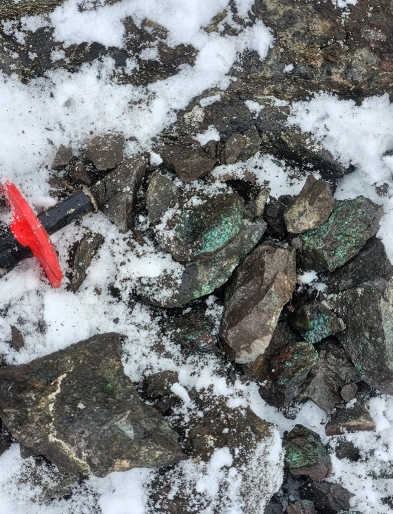
Malachite-bearing samples collected from the Beaman Adit area during the October 2025 field program. Green copper carbonate (malachite) staining is visible on sample surfaces. Click/tap images to enlarge.
Mineralized Float Below Main Zone
While attempting to access historic trenches (obscured by snow), the field crew observed large boulders with visible malachite on slopes below the historic Main Zone. Two grab samples were collected. These boulders are interpreted as talus likely derived from the Main Zone mineralization upslope, providing additional confirmation of copper mineralization in the area.
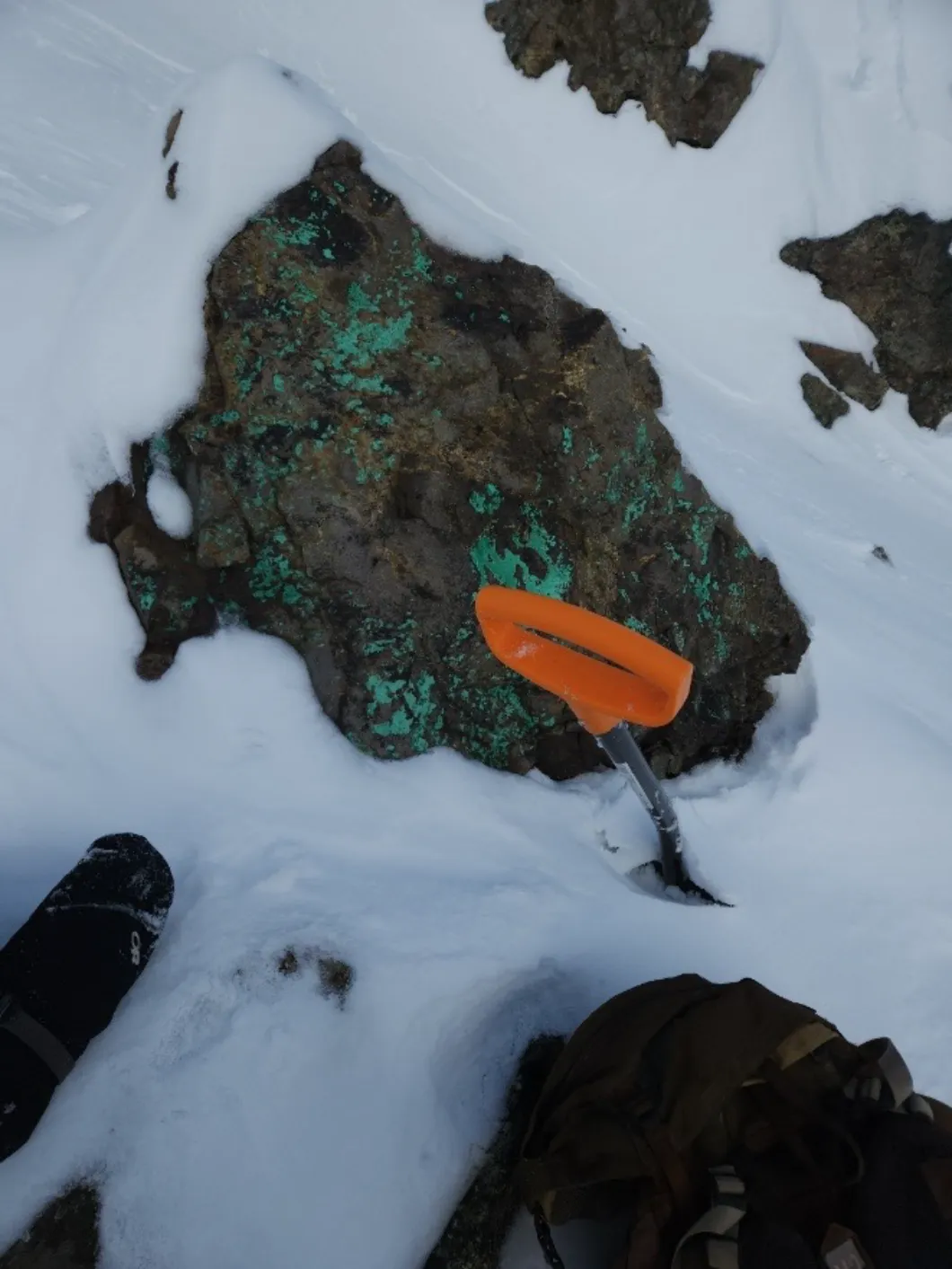
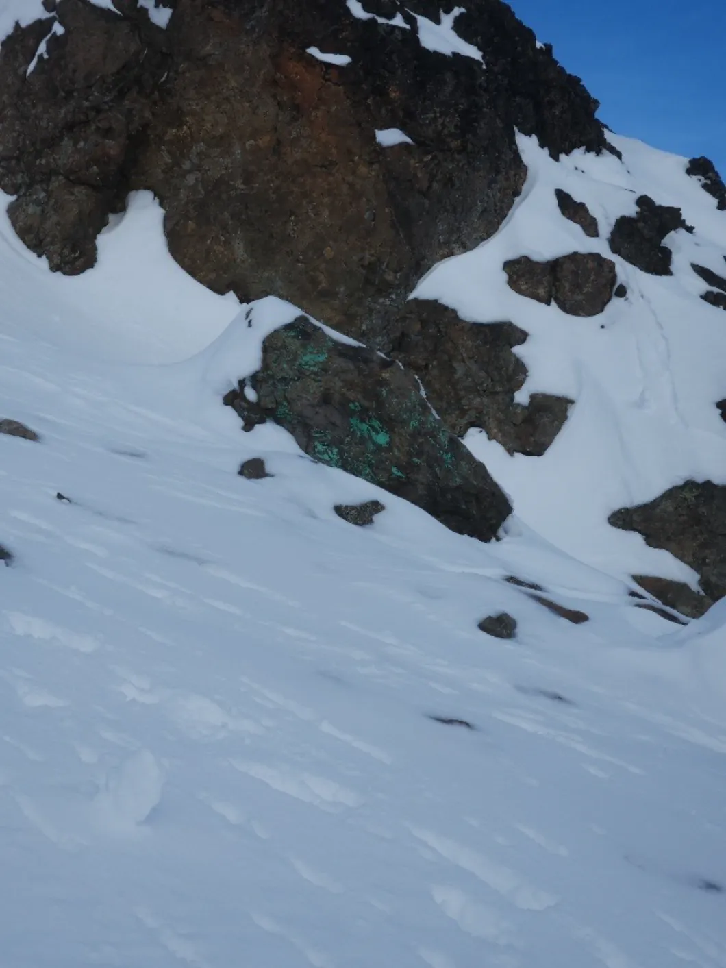
Malachite-bearing float boulders observed on slopes below the Main Zone. Click/tap images to enlarge.
The field crew located cross-stacked drill core. This core remains on property and is available for future examination, re-logging, and potential re-sampling for verification purposes.
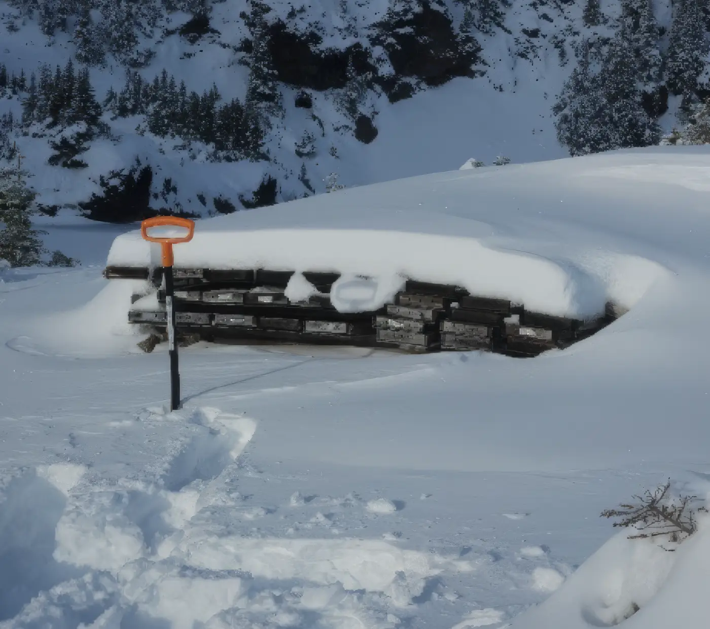
Historic drill core. Click/tap images to enlarge.
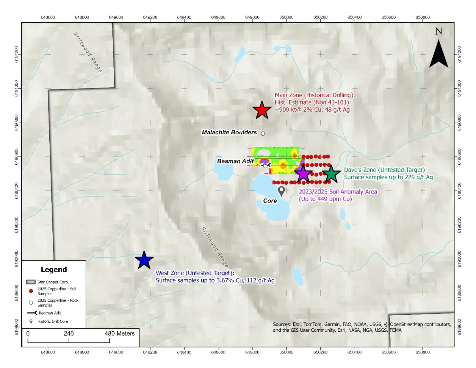
Property Overview and Target Map.Click/tap images to enlarge.
Several historically recommended exploration activities remain untested and represent priority targets:
Star Copper Corp. follows industry standard protocols for quality assurance/quality control (QA/QC) procedures in British Columbia. Samples are shipped under chain-of-custody protocols to Bureau Veritas Laboratories, an ISO/IEC 17025 accredited laboratory. At Bureau Veritas, samples are dried, crushed, split, and pulverized to 85% passing 200 mesh. Analytical procedures include multi-element ICP-ES/MS following four-acid digestion, with gold and precious metals analyzed by fire assay with an atomic absorption or ICP finish.
Star Copper implements a robust QA/QC program, including the insertion of a minimum 5% certified reference materials (standards), blanks, and field duplicates at regular intervals into the sample stream to monitor analytical accuracy and precision. The performance on the blind standards, blanks and duplicates achieved high levels of accuracy and reproducibility and has been verified by Jeremy Hanson, a qualified person as defined by NI-43-101.
Qualified Person
Jeremy Hanson, P. Geo., a Qualified Person as that term is defined under NI 43-101, is an independent contractor of the Company and has reviewed and approved the technical aspects of this news release.
Cautionary Statement Regarding Historic Estimates
The historic mineral inventory estimate of approximately 900,000 tonnes grading 2% Cu and 48 g/t Ag was prepared by Craigmont Mines Ltd. in 1973-74 prior to the implementation of NI 43-101 standards. A Qualified Person has not done sufficient work to classify this estimate as a current mineral resource. The Company is not treating this estimate as a current mineral resource. The estimate is included for information purposes only to demonstrate the historical exploration significance of the property.
TARGETS: Copper Creek
TARGETS: Pyrrhotite Creek
TARGETS: Star East
TARGETS: Star North
TARGETS: The Star