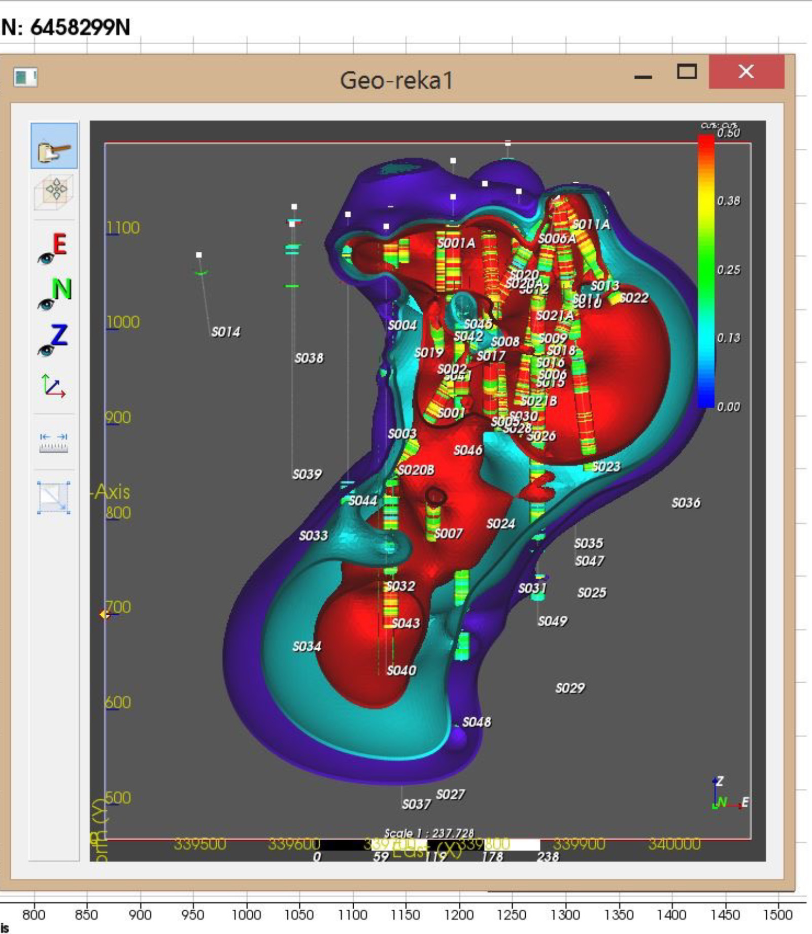
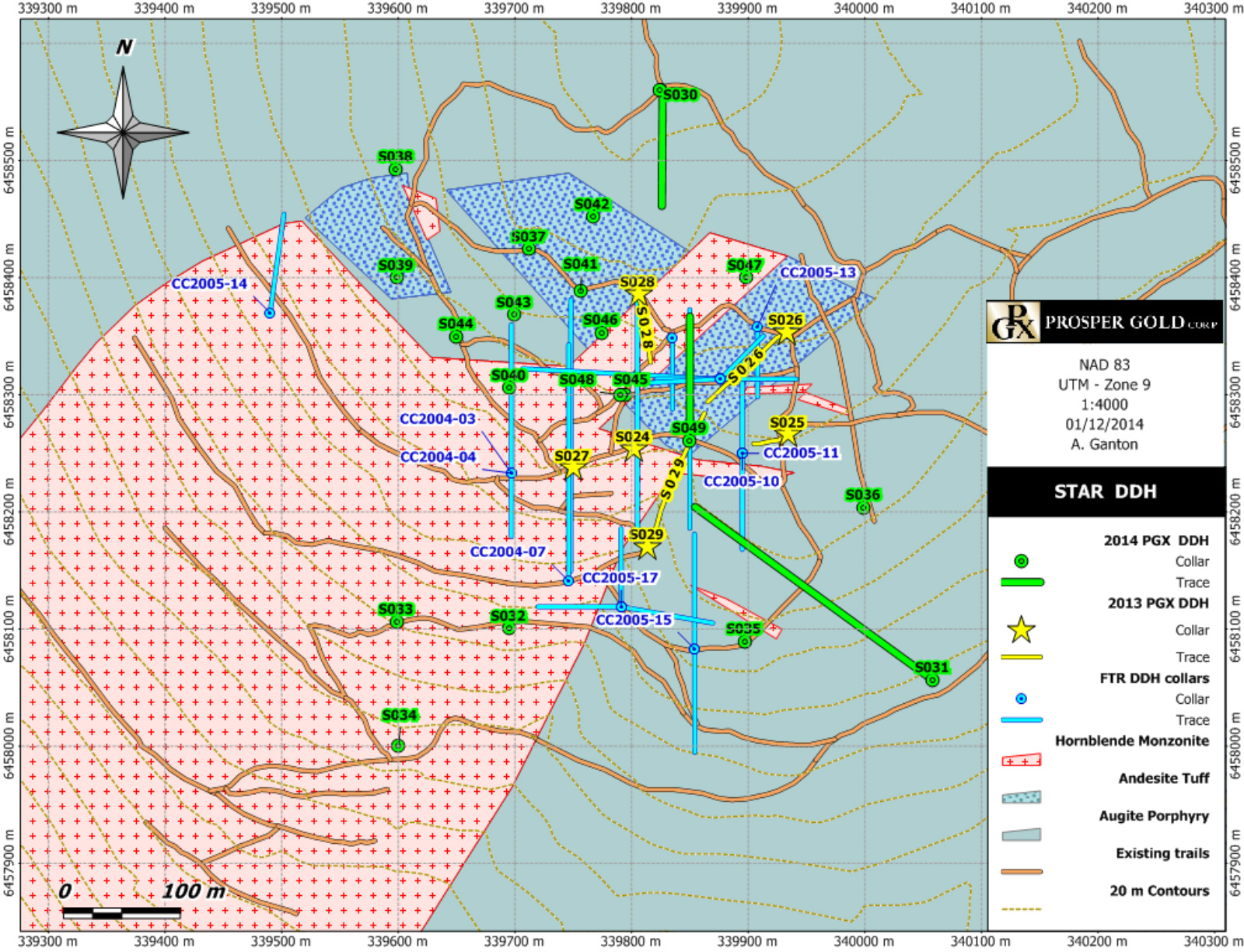
Drilling defined mineralized area 550m north-south and 350m east-west, mineralization as deep as 664m, open in multiple directions and to depth
The 2013 campaign largely confirmed previous results, of porphyry-style mineralization that extends to at least 600 m below the surface at the Star target.
2014 drilling expanded known mineralization at the Star target laterally and to depth.
To review drill tables with hole ID and coordinates please review 2025 N.I. 43-101 Technical Report.
2013 Drilling confirmed the deposit remains open to the north, west, northwest, northeast and to depth.
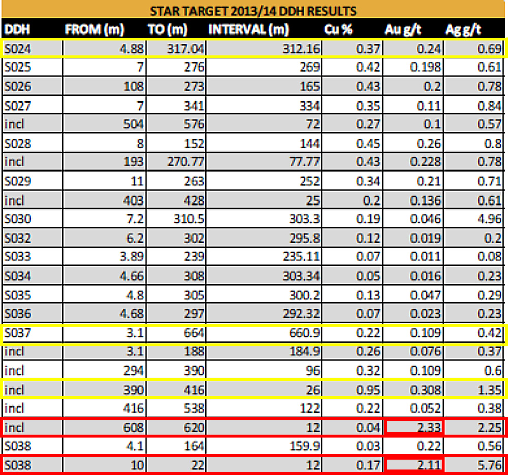
2014 drilling identified two previously unknown zones of highly silicified gold bearing rocks at depth in S037 (12m of 2.33 g/t Au) and near surface in S038 (12m of 2.11 g/t Au).
Click/tap image to enlarge.
Star Project Drilling
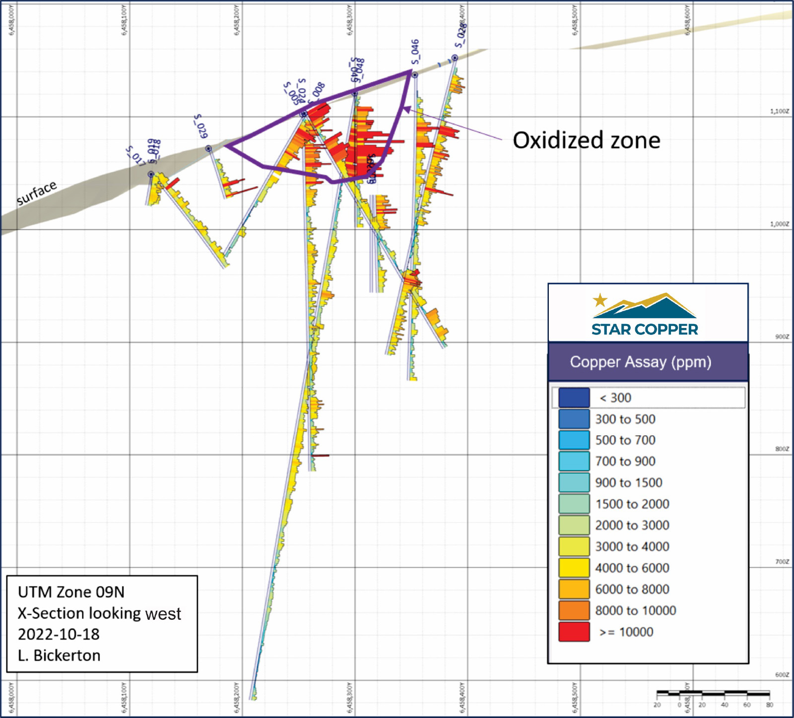
The surface oxidized zone above primary sulphide mineralization is dominated by malachite and azurite with local native copper, chalcocite and tenorite.
It was intersected in several holes enlarging the known high grade secondary material.
Analysis of the oxidized zone for acid soluble copper was completed by assaying 707 samples throughout 23 holes that contained copper carbonate and oxide minerals.
These samples were assayed using a sulfuric acid leach and AAS finish in order to determine the portion of copper sourced from copper oxide and carbonate minerals such as malachite, azurite, chrysocolla, cuprite and tenorite.
The overall percentage of copper that is contained in acid soluble minerals is 30.7%.
Intercepts that contained greater than 0.15% total copper ranged from 14% to 43.2% acid soluble copper.”
Click/tap image to enlarge.
Click/tap image to enlarge.
Star – view to NNW (above)
Moderate topography
Network of trails and roads coming from Airstrip
Younger volcanics (visible in background) may have covered the Star Property allowing for the perseveration of oxide zone